North Towards Prince Rupert (updated)
June 8, 9, 10
Tuesday (June 8) was grey without any favorable currents, but they put in long hours and went a good distance. On Wednesday they made excellent progress and are now getting close to Prince Rupert, where they expect to have cell service. With cell service they hope to get good information on weather and tides for the crossing the Dixon Entrance (open ocean) to Alaska.
David reports:
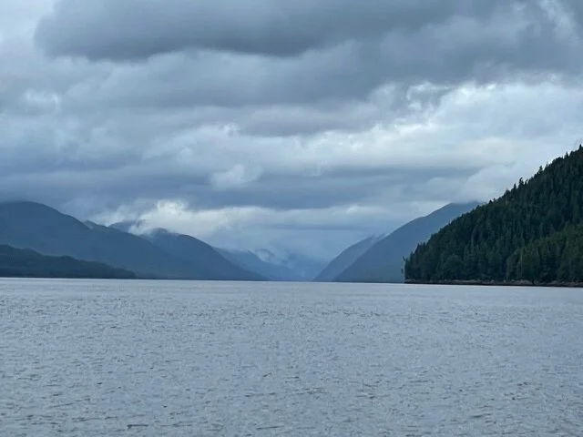
On June 9 the current ran just as the books said they would, unusual in our experience because all the channels confuse the currents. We got into the only channel, the Grenville Channel, otherwise known as the ditch! And ditch it is, high mountains on both sides and essentially straight with beautiful scenery, trees, rocks, snow and waterfalls.
Alex timed it by the books; we entered at the beginning of the flood tide going northwest. About the middle the tide turned to ebb northwest and flushed out towards Price Rupert. No choices to make.
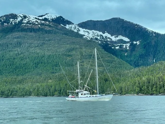
Three other faster boats started about the same time and disappeared ahead of us. We expected lots of boats because the ditch is the only route, but it was essentially all ours.
We can only put energy into propulsion that’s either coming in at the moment from the sun or has been stored in the battery. We came out even at the end of the day and traveled 42 miles along the only route! Average 3.5 knots on less than 2 kilowatts in and out through the motor. Yes, the overcast slows us down but this was another major milestone.
Alex writes :
“Another great day on the water. We managed to have current with us for much of the middle of the day, doing 5-6+ knots for several hours. Anchored tonight in Kumealon Island Cove at West Inlet. It was cloudy all day long and we ran the motor very slowly, on current cloud-shine alone, so as not to use the battery. As soon as we dropped anchor, the bright sun came out for about 15 minutes. That was warm and nice.”
David continues:
”We arrived here in time for rain and then a beautiful sunset. There are snow-capped mountains that sometimes show through the overcast. When they are not in sight, this area looks like Adirondack lake areas. After dinner Alex spotted 6 or 7 otters catching maybe 10” fish. Then they climbed a steep rock crevice to a cozy home in the trees. They can slide into the water even at low tide. The tides are 12-14 feet. At low tide, rocks that are completely covered at high tide block our view of all the Alaska Ferry except the bridge. There’s an eagle patrolling the point and islands, hoping to get something the otters miss.
June 10 am
In the morning a grizzly bear showed up at low tide eating stuff along the wide shore. The bear made a long trench in the mud finding food and stayed around for 3 hours while we breakfasted. We have 12X binoculars to spy on bears and to find navigation aids! We’re staying here today until high tide to get the help of some ebb current and to get a little more charge in the battery. It is overcast, then it rains for a while, then it’s sunny and then overcast again. However, we have added a few kilowatt-hours to bring the battery to about 1/3 full or 30 miles at night.
We’re close to Prince Rupert and some more Pacific Ocean to cross before getting to Alaska.”
They traveled a shorter distance that day (June 10), anchoring at Lawson Harbor to be in a good position to navigate Chatham Sound the next morning.
View of Alaska Ferry
Heading into Grenville Channel
Grenville Channel
KarmonDee from Sitka passing us in Grenville Channel
Route Map for Tuesday, June 8
Route map for Wednesday, June 9


