They Made It!
June 13
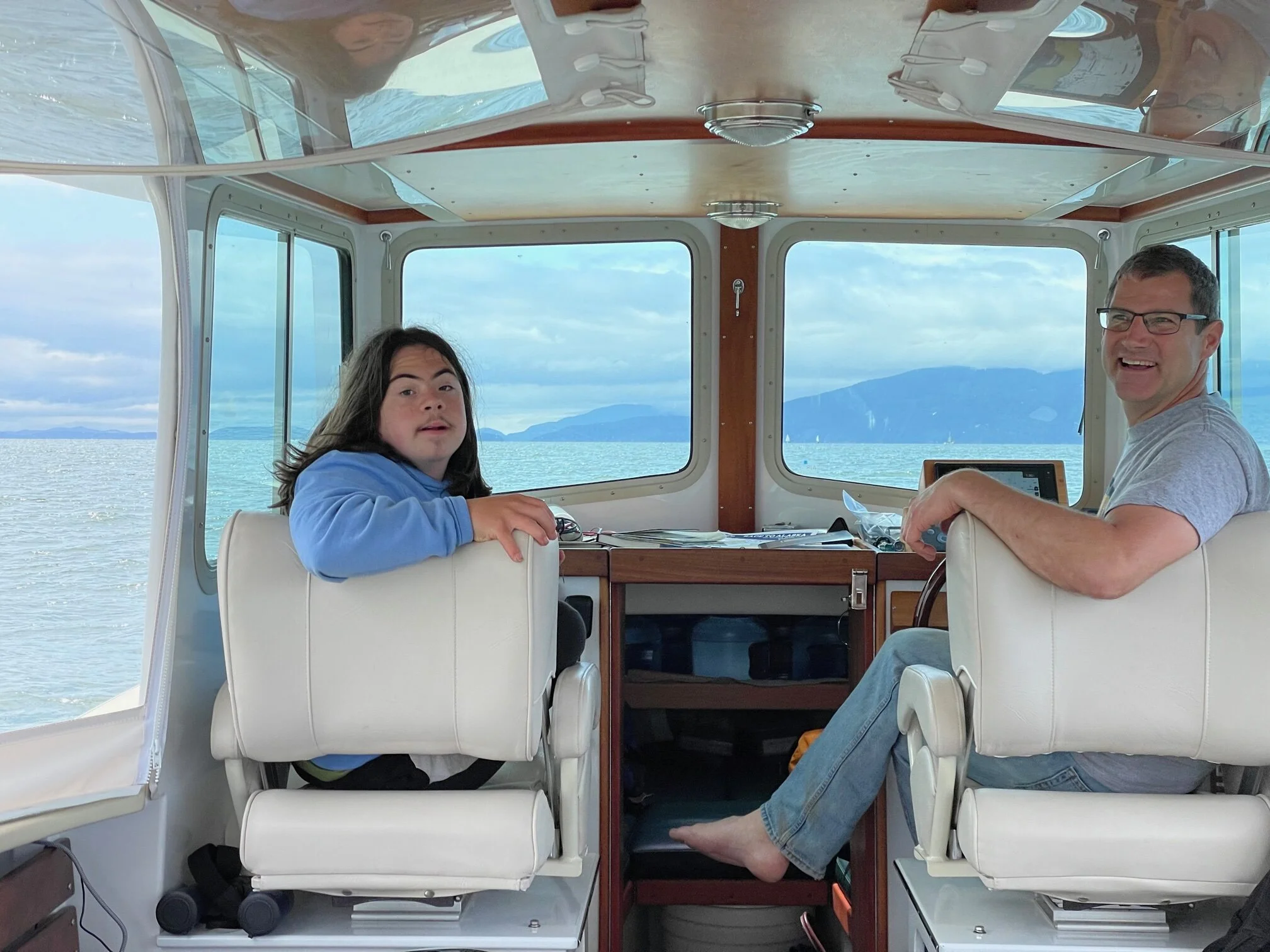
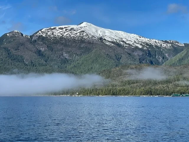
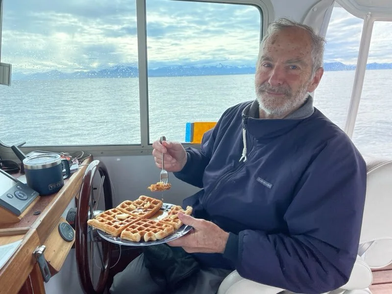
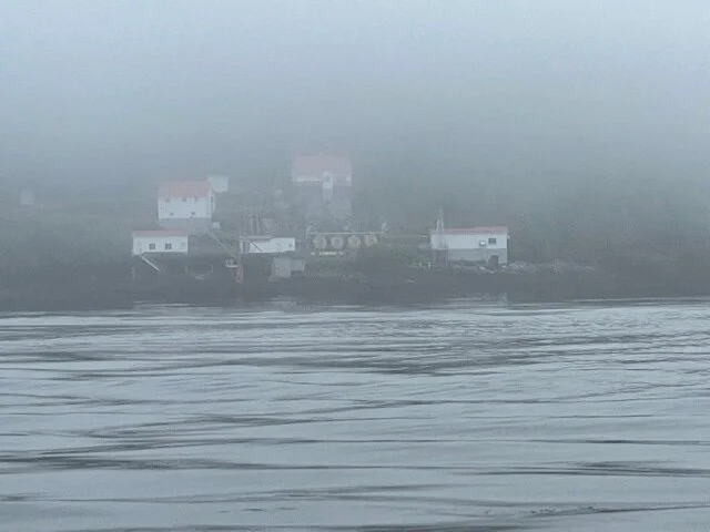
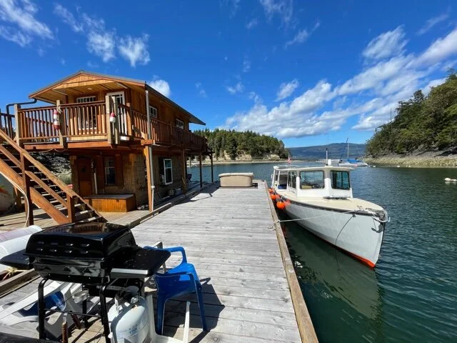
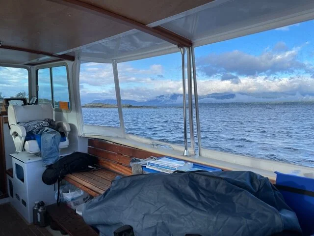
Alex and David arrived in Ketchikan late afternoon on Sunday, June 13! It took them 20 days after leaving Bellingham. In general the weather was cool, overcast and rainy with short breaks of sun now and then. They are happy to be here, and they’re enjoying using their legs to get around. I (Harriet) joined them Monday evening, and we will spend a few days exploring Ketchikan and Thorne Bay. Wayward Sun is docked, soaking up any sunlight, and ready to set forth again.
Good news is that, by taking apart the satellite equipment and adjusting the battery connections, Alex fixed the problem. So the satellite phone and the GPS tracker (https://forecast.predictwind.com/tracking/display/SV_WaywardSun) are now working again. Yay!
Below are some photos in Ketchikan and some videos made at Ham Island that express the joy of walking on land.
The next part of the voyage, north to Juneau and then to Glacier Bay, will hopefully be more relaxed with frequent trips ashore.

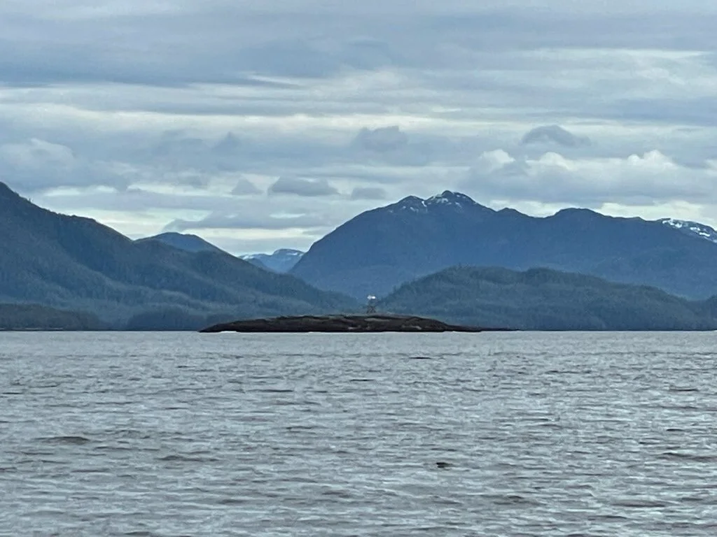
Ketchikan

Reunion in Ketchikan

Result of a woman’s influence

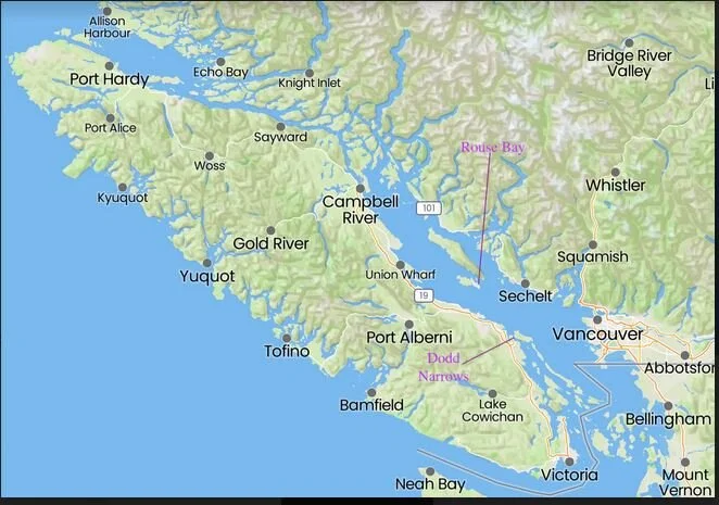
Main Waypoints Between Bellingham and Ketchikan

Route Map from Bellingham to Ketchikan
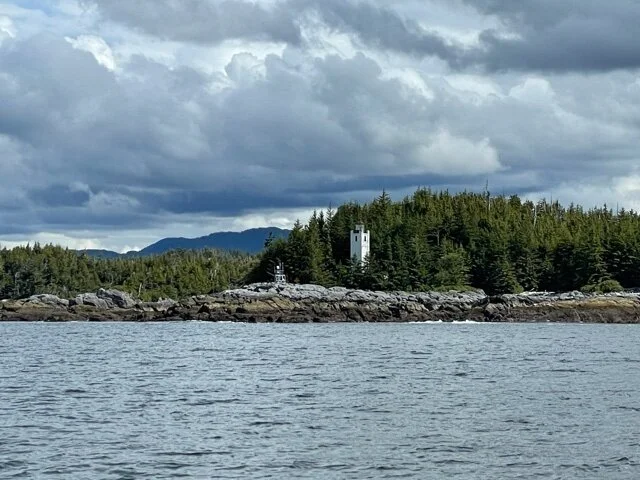
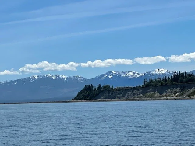
Arriving Ketchikan June 13
June 13
As of 3 pm (EDT) Sunday cell coverage is back! They successfully anchored over Saturday night at Ham Island, “a wonderful spot.” Alex took the dinghy ashore and actually walked on land. A welcome phone call and text from David described the previous day’s adventures:
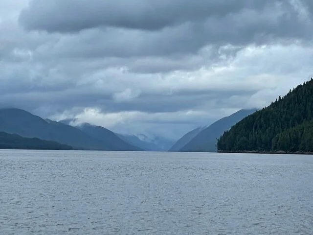
“Leaving our north-facing anchorage in Clam Cove (our last in BC), we could see Alaskan mountains over Dundas Island. In the channel we saw the Sir Wilfred Laurier, a Canadian ice breaker and research vessel. The Green Island lighthouse was ahead on the port side. Before 1906, when the light was built, that island was the site of major shipwrecks. One time after the light was working, its supply ship was late and it wrecked because oil for the lights had run out. We and the light are on the major shipping route to Alaska.
Rounding Whitley point we could see the Alaskan shore, and we headed across the Dixon Entrance to the border and towards the Tree Point lighthouse.
While there was a spot of cell phone coverage Alex filed the US customs app. Then there was no cell, then cell again and we we’re admitted back into the US, then no cell.
We headed north, took a shortcut through Danger Pass and kept going in overcast and rain using some battery.
I’m writing this Sunday morning in Ham Island Bight, our night harbor with our local harbor seal. The sun was coming up at 4 when I had to get up, and the sea was up to the trees. Now it is on its way down 16 feet, then we’ll be off to Ketchikan. At breakfast we heard whale spouts on the other side of the tidal bar. We’ll be looking for cell service since our satellite hardware is not working.”
They are now well on their way to Ketchikan, expecting to arrive by mid-afternoon.
—————————————
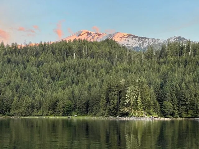
A couple of days ago, when they regained service after losing it for several days, they sent a number of photos and videos that they had been collecting. Below is a selection.
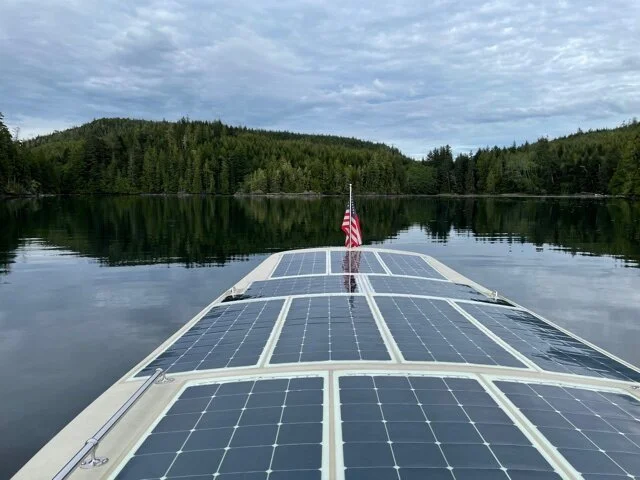
Wayward Sun Power Source
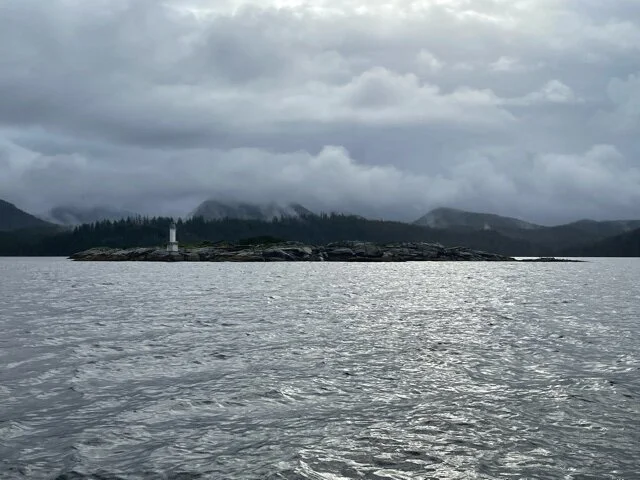
Lighthouse, June 5
Reid Passage, June 6
Fog lifting after leaving Klemtu, June 7
Looking South from Green Point, Khutze Inlet, June 7

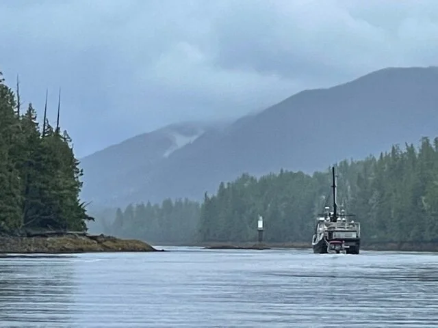
Canadian CG Wright Sound Near Hartley Bay, June 8
Looking South from Grenville Channel, June 8
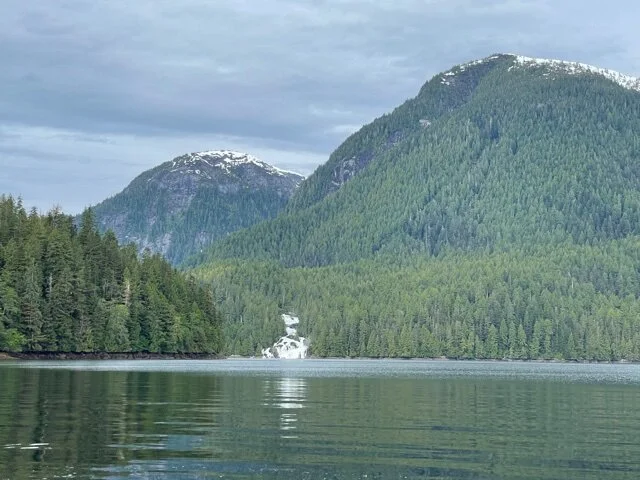
Waterfall at Butedale, June 8

Grizzly, June 10
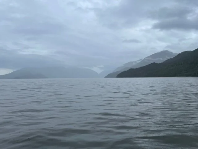
The Dixon Entrance: Entering U.S. Waters
June 12
David and Alex left Clam inlet around 6 am in the rain, but that lasted only a couple of hours. They crossed the border today, which they noted when the time on their phones shifted back an hour! Thankfully they had a safe crossing of the potentially troublesome Dixon Entrance. I (Harriet) talked to David about 9:30 pm eastern time and they were headed for Ham Island, about 5 miles away. I'm assuming they made it. It's only 15 miles SE of Ketchikan! Long day today: about 15 hours of travel and approximately 50 miles.
The GPS tracker stopped working around 7 pm EDT; no word on when it might be fixed. They think it may be a hardware problem with their satellite equipment. I assume that also means no satellite phone, and they probably won’t have cell again until close to Ketchikan.
I plan to fly to Ketchikan and meet them Monday evening, so I’m not sure when the next blog entry will be.
After visiting Ketchikan and Thorne Bay (where David spent a summer logging when he was in college), they will head north again to Juneau and hopefully Glacier Bay.
For those who are wondering, Wayward Sun will come home on the Alaska Ferry from Juneau to Bellingham.
Breakfast on the Ocean (June 12)
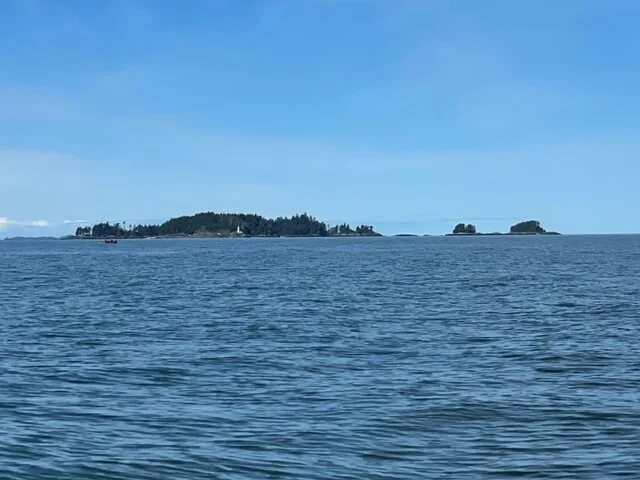
Lord Rock
Lord Islands
Whale Rock, Just outside of Danger Passage
Tree Point Lighthouse
Crossing Chatham Sound
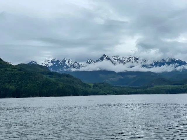
June 11
They left Lawson Harbor very early and started across the open water of Chatham Sound. It was calm in the early hours, but the wind picked up later. The videos tell the story. At the end of the day they anchored at Clam Inlet on Baron Island, just south of Dundas Island.
Tomorrow they plan to round the corner of Dundas Island and head into the Dixon entrance to Alaska. If all goes well, after tomorrow they will have one more day before reaching Ketchikan.
Lucy Islands, Chatham Sound

Route Map June 11
North Towards Prince Rupert (updated)
June 8, 9, 10
Tuesday (June 8) was grey without any favorable currents, but they put in long hours and went a good distance. On Wednesday they made excellent progress and are now getting close to Prince Rupert, where they expect to have cell service. With cell service they hope to get good information on weather and tides for the crossing the Dixon Entrance (open ocean) to Alaska.
David reports:
On June 9 the current ran just as the books said they would, unusual in our experience because all the channels confuse the currents. We got into the only channel, the Grenville Channel, otherwise known as the ditch! And ditch it is, high mountains on both sides and essentially straight with beautiful scenery, trees, rocks, snow and waterfalls.
Alex timed it by the books; we entered at the beginning of the flood tide going northwest. About the middle the tide turned to ebb northwest and flushed out towards Price Rupert. No choices to make.
Three other faster boats started about the same time and disappeared ahead of us. We expected lots of boats because the ditch is the only route, but it was essentially all ours.
We can only put energy into propulsion that’s either coming in at the moment from the sun or has been stored in the battery. We came out even at the end of the day and traveled 42 miles along the only route! Average 3.5 knots on less than 2 kilowatts in and out through the motor. Yes, the overcast slows us down but this was another major milestone.
Alex writes :
“Another great day on the water. We managed to have current with us for much of the middle of the day, doing 5-6+ knots for several hours. Anchored tonight in Kumealon Island Cove at West Inlet. It was cloudy all day long and we ran the motor very slowly, on current cloud-shine alone, so as not to use the battery. As soon as we dropped anchor, the bright sun came out for about 15 minutes. That was warm and nice.”
David continues:
”We arrived here in time for rain and then a beautiful sunset. There are snow-capped mountains that sometimes show through the overcast. When they are not in sight, this area looks like Adirondack lake areas. After dinner Alex spotted 6 or 7 otters catching maybe 10” fish. Then they climbed a steep rock crevice to a cozy home in the trees. They can slide into the water even at low tide. The tides are 12-14 feet. At low tide, rocks that are completely covered at high tide block our view of all the Alaska Ferry except the bridge. There’s an eagle patrolling the point and islands, hoping to get something the otters miss.
June 10 am
In the morning a grizzly bear showed up at low tide eating stuff along the wide shore. The bear made a long trench in the mud finding food and stayed around for 3 hours while we breakfasted. We have 12X binoculars to spy on bears and to find navigation aids! We’re staying here today until high tide to get the help of some ebb current and to get a little more charge in the battery. It is overcast, then it rains for a while, then it’s sunny and then overcast again. However, we have added a few kilowatt-hours to bring the battery to about 1/3 full or 30 miles at night.
We’re close to Prince Rupert and some more Pacific Ocean to cross before getting to Alaska.”
They traveled a shorter distance that day (June 10), anchoring at Lawson Harbor to be in a good position to navigate Chatham Sound the next morning.

View of Alaska Ferry
Heading into Grenville Channel

Grenville Channel
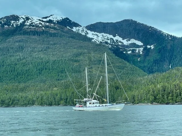
KarmonDee from Sitka passing us in Grenville Channel

Route Map for Tuesday, June 8

Route map for Wednesday, June 9
North from Klemtu
June 7
“At 6 am we started north from Klemtu in a heavy fog. At 7 we had our 10 o’clock (EDT) phone call about the electrical sytems for the fiberglass 24’ boats.
There are two channels, thin and wide, on either side of Sarah Island. We chose the thin one as it is the ferry route. Our tide tables said the tide was with us. However all morning, along the 17 miles of thin channel, the tide was against us. We figure that the tide got up the wide channel first and came back at us, a huge back eddy. Very slow. But it was a beautiful sunny day after the fog lifted, and 4 or more dolphins played around the boat at Quarry Point. Alex is adept at finding small back eddies along the shore. We stopped fighting the tide for 3 hours in Swanson Bay in the overcast. The place was an industrial center in the early 1900s. The brick chimney for the lumber and pulp mills still stands in the trees, and pilings from the old docks line the shore. We went 10 more miles in the rain to Khutze Inlet for the night.”
Leaving Klemtu early morning

David offers the following description of solar cruising:
“Looking around we see snow-capped mountains, rocky shoulders and cliffs, evergreen forested slopes with waterfalls, some all the way from the melting snow right down to the water. Typical overcast day, typical overcast week.
So here is a hypothetical description of a typical day: The propulsion motor is quite constant based on where we set the throttle. The wind and currents change speed and direction moment to moment, as does the sun level. For the “typical” day, the sun is 1/3 of a sunny day and delivers 400 watts from the solar panels to the boat. A 10 hour day delivers 4000 watt-hours which could run our 4000 Watt motor for only one hour. That obviously won’t get us far. So we run on current sunshine at 400 Watts. 400 Watts moves the boat at 3 knots in calm water with no wind! 3 knots for 10 hours gets us 30 miles closer to Alaska! Then there is the tide: 1 knot against us means 6 hours to go 12 miles. If the current is with us it only takes 3 hours to go 12 miles.

Waypoints of the journey through June 6
Traveling to Klemtu
June 6
Alex and David Left Mouat Cove very early this morning, traveling through Perceval Narrows, and later in the day through Jackson Passage, to the town of Klemtu. They started out in bad weather but it improved, even becoming sunny in the late afternoon. They traveled slowly enough to put some charge in the battery.
Here’s David’s detailed description:
“We left Mouat and started toward Millbanke Sound. The swells from the Pacific were enough to be our horizons when we were in a trough. We turned north inside Cecilia Island and dodged the rock islands where the swells were crashing. The Reid and Mathewson Channels were calm and beautiful, but the overcast sky made us slow down in order to maintain good battery level. In Jackson Passage we caught a sunny break to get us to and across Finlayson Channel. Here again we found Pacific swells. Behind Cone Island it was calm to Klemtu. Alex got a message we needed to make a phone call at 10 EDT, and since Klemtu has cell service, we anchored for the night.”
They took advantage of the cell service to also send a few photos. The views of Wayward Sun were taken from the dinghy.
The map, as always, was prepared by Chuck Borton. The dotted line you see on the maps is the ferry route.

Arriving. Looking north into Klemtu Passage
Late afternoon, anchored at Klemtu

Wayward Sun

Bella Bella and Environs
June 5
The evening of June 5 David wrote:
“Today after leaving Namu, we went 27 miles to Bella Bella and then 12 miles further. We passed the Hakai Institute, which I wanted to visit but couldn’t due to COVID restrictions. Likewise the culture in Bella Bella. Around 1pm we docked at the Shearwater Marina in Bella Bella to stock up on water and other provisions. And we had a take-out meal from the restaurant! We would have liked to visit, eat in the restaurant, have a shower and use the laundromat. This area has lots to offer; if I come back I plan to stay days instead of 2 hours. Today was light rain, heavy rain, and threatening rain. The overcast keeps the battery low and slows our travel. However passing Bella Bella was another big milestone! Ahead are less people, less places with cellular, and more immersion in forest and water passages.
Love to those who care to read this. Good night from Mouat Cove.”
Note: At Bella Bella they had cell service and could send a bunch of photos and videos. Below are the ones from June 5; I have inserted those from the past several days into the appropriate blog entries.

Lama Pass

Approaching Bella Bella

Old Bella Bella Coast Guard Station

Midday meal. Takeout from the restaurant!

June 5: From Namu to Bella Bella to Mouat Cove
More Struggles with Fitz Hugh
June 4
David wrote:
“Today going north up Fitz Hugh Sound was a little difficult. It has been overcast with a 10 knot wind building behind us. We were going well on 1/10 throttle, which doesn’t use up much battery. The wind might have reached 15 knots, certainly gusts that high, and higher waves. At times we had to throttle up to 25% power to maintain steerage.
Looking ahead, one specific headland was usually sunnier than anywhere else. It was Namu Harbor, and we found a gusty wind on the starboard side before getting there. A theory is that Namu Ridge south of the harbor caused both the strange wind and the hole in the overcast. Being tired of 6 hours of difficult steering, we stopped in the harbor at Rock Inlet for lunch and a break.
The books say there was a long-standing community at Namu, as well as a thriving fish cannery in the 1900s. But an insufficient supply of fish caused the cannery to close around 1970. Now Namu is a ghost town and the harbor is lined with falling down buildings. Someone tried to make it a resort, but that was too expensive. Several local groups are trying to get help to clean up the large and dangerous mess.
Lunch is always a high point of the day, and our 3-hour break combined with the local break in the overcast (despite a few showers) gained us a 12% increase in the battery. It is still stormy after 3 hours, so we will move deeper into the bay for more protection and plan to set off again tomorrow morning when the wind and rain are supposed to be lighter.”

Ghost town of Namu

Battling Fitz Hugh Sound
June 3
David wrote:
“This morning, June 3, was tough. Up and off at 6, around Kelp Head out in Queen Charlotte Sound. Pacific swells were big enough that we couldn’t see the horizon all the time. We called it Rock ‘n Roll. Making it harder and slower was the overcast sky, current and wind against us, and lowish battery. After crossing Rivers Strait, we anchored in Fury Cove on Penrose Island. It’s beautiful—some sandy beaches, trees and rocks, and views out into the strait. It is also very good protection. We had a lunch of PB&J, ice tea, pistachios, and even dark chocolate! The scenery looks like Maine. And we gained 10% in the battery.“
After lunch, the sun came out! So they set out again, thinking the current would be with them, but it wasn’t. And the wind and waves were against them as well. They took evasive action behind Addenbroke Island, where the going was smoother, and then traveled to Green Island to anchor for the night, another beautiful spot. Alex says, “Everything is beautiful here! Every single rock and island and tree and mountain. And there are lots of all of those.”
Alex found later in one of their books that Fitz Hugh Sound never really floods (towards Bella Bella, where they are headed)—Just always ebbs against them. They will “adjust their strategy accordingly”.
Weather forecast is for real rain the next few days, so progress will likely be slow. We are grateful for communication by satellite phone, although it’s sometimes difficult.


Overcast morning

Overnight at Green Island

Harbor Seal Groupie. He followed the dinghy for a while

The dinghy gets some use even if we can’t go ashore
Rounding Cape Caution
June 2
Alex and David left Lewis Bay early in some fog and drizzle and headed north toward Cape Caution, which is a headland along the Central Coast of British Columbia. It is the point where Queen Charlotte Strait meets Queen Charlotte Sound, named by British maritime explorer George Vancouver in May 1793 for the turbulent waters and rocky coastline found in the vicinity.
David writes: “Rounding Cape Caution the seas were calm with a slight following breeze. There were rolling swells from the Pacific and showers all around. We got few sprinkles but the overcast skies gave us only one third the power we needed. Good thing we had stored up some solar energy earlier. Between Cape Caution and Egg Island we saw more activity than all the rest of day. 3 tugs with barges, 3 tugs without barges, and a Coast Guard helicopter landed and took off. Tomorrow depends on wind, tides, and sunshine!”
After rounding Cape Caution, they crossed Smith Sound and anchored in Millbrook Cove for the night. They said it’s a beautiful spot, and they got to watch lots of eagles. It was a very long, 12-hour day of cruising.
As expected, they have lost cell coverage now and are still getting used to using the satellite phone.

June 1: Route from Growler Bay to Lewis Cove with stop at Telegraph Cove

June2: Route from Lewis Cove, around Cape Caution, to Millbrook Cove
Queen Charlotte Strait
June 1, 2021
David and Alex started out from Growler Cove in fog and overcast skies, headed to Telegraph Cove for ice and a few provisions. By the time they arrived mid-morning, skies had cleared nicely. They traveled slowly, about 3 knots, allowing the batteries to charge as they went. This will be the last taste of civilization for an unknowable time, as they then headed north into Queen Charlotte Strait. They had good views of Silverthrone Glacier.
David writes:
“As of June 1 we have one week of cruising down; now into the unknowns of Queen Charlotte Strait and beyond. Before the start I knew to use current sunshine and go with the tidal currents. Now I really know it. I’ve also learned that the tidal currents in passages, straits and around islands are not knowable, you’ve got to go with the best guess and adjust. Yes, navigation apps help a lot, but then there’s the details.
Today we are going north, headed for the north shore of the strait. Sometime we will be headed northwest in a relatively straight line to Alaska.”
They anchored for the night in Lewis Bay, on the north side of Queen Charlotte Strait. “heavyish wind, in nice harbor.” They report seeing 3 pods of dolphins.
Alex has configured the satellite radio and GPS so that the following link will update their position every hour! https://forecast.predictwind.com/tracking/display/SV_WaywardSun

Entering Telegraph cove
Docked for Provisions
Looking at Silverthrone Glacier
West End of Johnstone Strait
May 31
Sunday Night they thought they would stay put at Veer Cove during the next day to let the batteries charge. However in the morning (Mon May 31) they decided to travel after all because the current was with them. Even with overcast skies they were going 5 knots along Johnstone Strait without using battery power. They were getting decent sunlight through the clouds, and the battery charge even increased. They saw a humpback whale!
They anchored Monday night in Growler Cove. Happily they had no adverse currents getting there, unlike the previous night getting into Veer Bay. That evening after turning to get to the entrance, they encountered unexpected adverse currents of 5 knots. They were going 6 knots through water coming at them at 5 knots, a net forward motion of 1 knot. Difficult and a bit tense—notice the whirlpools in the video! They are now finding it helpful to use the Navionics chart to find information on currents, which is how they chose Growler Cove.
Tomorrow (Tuesday) morning they are planning a stop at Telegraph Harbor. Alex phoned someone there and learned they can deliver ice, milk and oatmeal to the boat! And tomorrow promises some sunshine—that will be a welcome change.


Franklin Range, West end of Johnstone Strait

Route traveled on May 31.
Annotated maps prepared by Chuck Borton
Seymour Narrows
May 30
Yesterday afternoon, as they got closer to the approach to the infamous Seymour Narrows, they passed Cape Lazo and other beautiful scenery. They stopped at Shelter Point and cooked dinner while awaiting favorable currents (as advised) before continuing to Campbell River, their goal for the night. They finally were anchored in Gowlland Bay, across from Campbell River, and ready to turn in by 11pm. Considering they left Lasqueti Island at 5 am, that was a long day!
This morning they were off around 6:30 am in light rain to catch the 8:30 am slack tide for going through Seymour Narrows. There were about a dozen other boats with the same idea, as going through at any other time is hazardous for small boats. They went slowly to conserve battery power and made it through with no problems. As the rain slowed to a drizzle they were going 3 knots, getting ~650 watts from the sun, using ~200W for propulsion, and putting ~400W into the batteries. Pretty good to charge the batteries even in drizzle!
After negotiating Seymour Narrows, Alex and David continued north up Discovery Passage and then into Johnstone strait. They anchored overnight in Veer Cove, at the west end of West Thurlow Island.
Cape Lazo, Vancouver Island

Successfully through Seymour Narrows

Approaching Chatham Point at the north end of Discovery Passage
Break in the overcast along Johnstone Strait

Strait of Georgia, Heading Northwest
May 28-29
Yesterday, May 28, was a light day. Alex and David left Rouse Bay mid morning and traveled about 6 miles up the east coast of Lasqueti island, through Little Bull Passage, to Scottie Bay. There friends of Alex’s buddy, Mark Harfenist, had learned of the voyage and came to the boat to greet them. They tied Wayward Sun (by permission) to an unoccupied houseboat unattached from shore. (David and Alex did NOT go ashore.) They had fun and relaxing time. An excellent day.
Today, Saturday, they were off at 5 am and headed northwest. It’s a sunny day but strong headwinds are slowing them down and making rough seas. It will be a long day. They are hoping to reach Campbell River, a bit south of Seymour Narrows.
May 28: Little Bull Passage, between Rouse Bay and Scottie Bay
Alongside houseboat at Scottie Bay

Mt. Arrowsmith on Vancouver Island

Limestone mine, Texada Island
Across the Strait of Georgia
May 27
In spite of windy conditions and some rain, the guys put in a full day today. After leaving Ruxton Island in the morning, they went through Dodd Narrows, passed Nanaimo, and crossed the Strait of Georgia to Lasqueti Island (Rouse Bay) to anchor for the night. Crossing the strait was rough, and they were glad to reach their destination around 6pm. They reported seeing an eagle catch a fish.
They traveled 31 miles today, 58 yesterday and 106 miles total since leaving Bellingham on Tuesday afternoon.
Tomorrow’s weather does not look good, so they plan to take it easy, allowing themselves and the batteries recoup some strength. Weather over the weekend promises to be better.
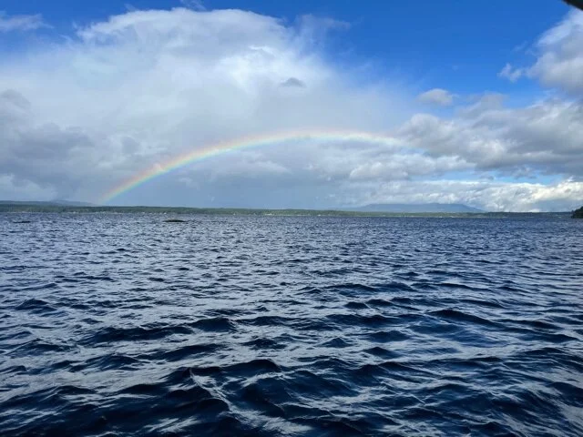
View at anchor off Ruxton Island, morning of May 27

Rainbow view from Ruxton Island
Making Hash Browns

Dinner at Rouse Bay— 2nd night in BC

Doing dishes at Rouse Bay
The morning of May 28 David writes:
Besides scenery and the eagle catching a fish, we saw noisy Canada geese, adult and small otters, harbor seals, and 3 Orcas just swam across the mouth of Rouse Bay.
Into Canadian Waters
Wednesday May 26
Alex and David left Sucia Island Wednesday morning for their first full day of travel. That was the last time they’ll set foot on land until they get to Ketchikan! They headed northwest toward Sydney on Vancouver Island where they presented themselves at Canadian customs. They passed inspection and were allowed to continue with the warning that they were not to go ashore. The official grudgingly said they could stop for ice as long as it was delivered to the boat and they did not get out.
Continuing up the east side of Vancouver island, they passed Channel Islands and Spring Island, traveling between 4 and 5 knots, even though it was overcast. At 7:30 pm they stopped for the night near Ruxton Island, anchoring in Herring Bay. The battery charge was just over 50%. A good day! Thursday is supposed to be rain all day, so they will make little if any progress.

East Wing Cove at Sucia Island— last land!
Haynes Peak on Salt Spring Island
Passing Channel Islands

View at anchor, Ruxton Island
Another view at Ruxton Island
Fixed and underway again
Tuesday, May 25
Alex tells the story of diagnosing and fixing the problem:
Yesterday as I was diving under the boat to replace the propeller I noticed the lower gudgeon on the rudder was bent and the pintle and rudder were almost 3/4 of an inch raised up from where they should be. As we were on the phone with Daniel from Torqeedo trying to figure out what might be wrong with the motor Dad and I banged on the pintle and got it halfway back down. This made the rudder shake less, but still shake. Curiously the motor was working just fine. At the time we thought there were now two problems, one with the motor and one with the rudder. We were all scratching our heads about this one. Did the motor somehow cause the shaking and the shaking caused the rudder to ride up in its hinges? Maybe if the splines sheered off the inside of the propeller, that would explain it. But upon inspection the prop was good as new. What caused the motor to not turn the propeller more then a little at 1000 watts of power while we were in distress yesterday? Still a mystery.
Torqeedo amazingly decided to overnight a new pod motor to us.
To address the rudder problem Sam gave us the part numbers, heroic friend Ricco got to Fisheries Supply before it closed, and I drove to seattle last night to get the new gudgeon.
Also last night, Dad woke in the middle of the night and realized two things - the first that the rudder riding up in the gudgeons was what caused the distressing shaking we experienced. And it made sense that as the throttle increased the shaking increased because of more pressure on the rudder. But at the time we had no idea there was anything wrong with the rudder.
The second thing he realized is that as he was watching me in the water and the boat drifting he most likely mis-read the throttle - thinking it was at 1000 watts but really he had it just at 100 watts. That would explain why I saw the prop spinning just a little, and the second time we did this why the boat was just barely moving at what we thought was 1000 watts.
I woke in the night wishing I had played with the throttle some myself and generally messed around with things a bit more before we called for the tow. But I was hypothermic and consoling my son and we were all shaken up by the boat’s shaking and rapidly drifting into shipping lanes and it was obvious there was some big problem.
So, in hindsight, we believe our trusty Torqeedo motor is and always was totally fine. And we cried wolf and ended up with an extra Torqeedo pod drive for nothing. (Which we will gladly return to Torqeedo after our trip assuming we don’t need it)
Oops!!
And still mega gratitude to Daniel and the folks at Torqeedo who went above and beyond to help us out of a mysterious yet distressing situation. We are so glad to know you have got our backs!
That brings us back to today. As soon as we got hauled out it was obvious the pintle was bent as well as the gudgeon. I kicked myself for not also getting a new pintle in Seattle yesterday. But the folks at the local boatyard hooked us up. They were too busy to do the work themselves, but they let us borrow tools. We torched and banged and viced and bent the pintle back to true. All the parts amazingly re-installed smoothly and we splashed down and got underway at 2:30. Currently 5:00 pm and going 6.5 knots with some favorable current and 2/3 sunshine and 1/3 battery power.
Talking to Sam again he said it is customary to have a rocky beginning to a long journey, so we got that right!

Ready for haul out

Before

Fixing pintle

up close

Fixed!

Ready to go again
—————————————————-
Day one of restarted voyage
They left Bellingham for the second time about 2:30 pm on Tuesday, May 21, bound for Sucia Island to spend the night.
There was no fanfare for this departure, but here’s a video of the first time, 2 days earlier.
They arrived at Sucia IslandTuesday evening. Very happy to be there for their first night out.

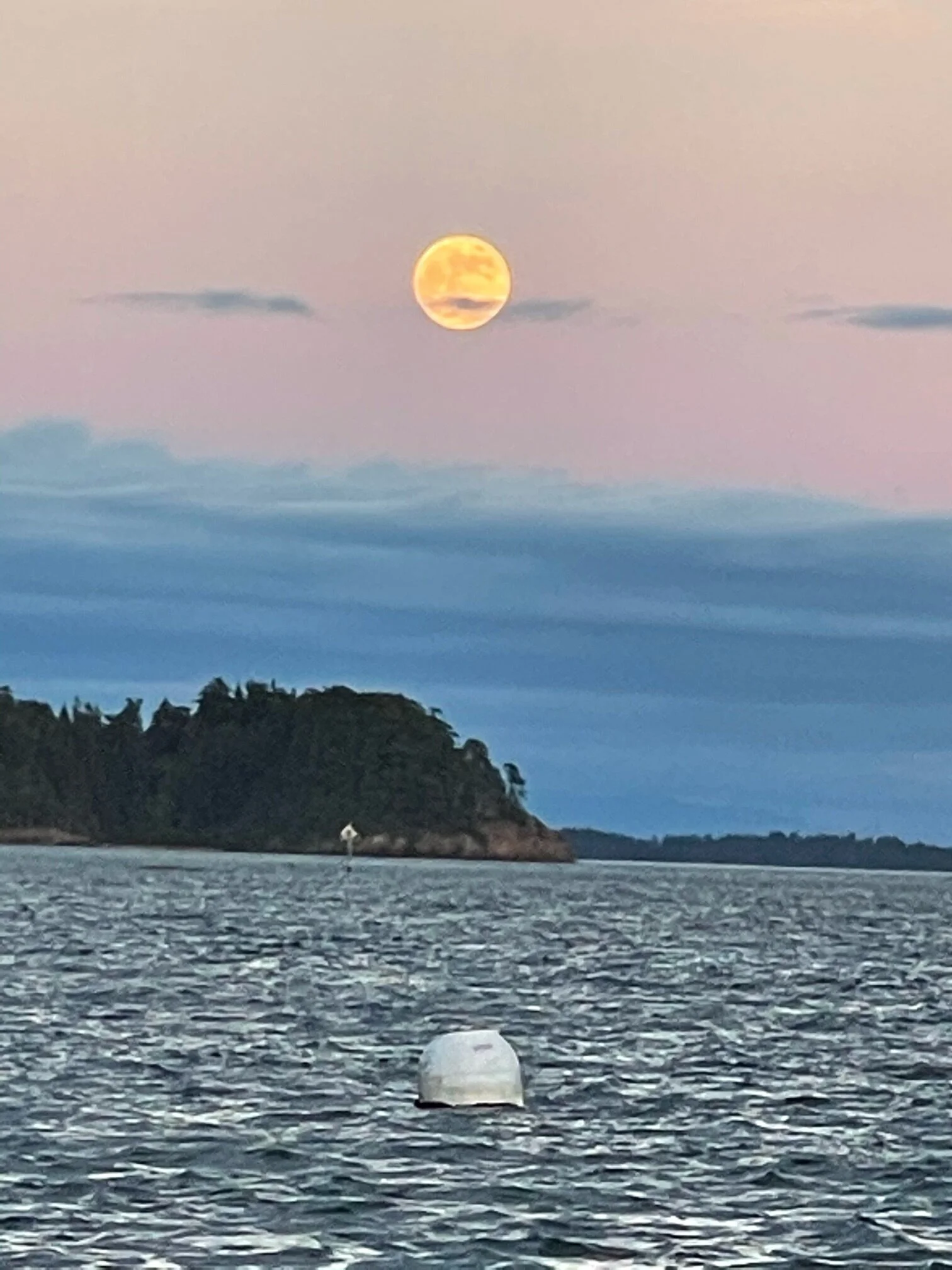
Full blood moon seen from Sucia at 9pm
Alaska Day 1 Adventure – misadventure
[As of today, the most recent updates will show up first on the screen. Those who are joining now can see background information by going to the menu bars in upper right.]
Submitted Monday evening, May 24
We---Alex and his son Kai, and Granddad David---got a wonderful send off just past the crack of noon on Sunday from our slip in Bellingham. It was variably overcast, not unusual, with very roughly 20 to 40% of full sun solar input. Wayward Sun is well provisioned with food and water and so is a little heavier and lower in the water than usual. We were traveling ~ 5 knots using about 1300 W with our 4000 W Torqeedo motor.
About 2 hours out Alex spotted whale watching boats and we took a brief detour to see whale spouts, a few flukes and black backs, we’re not sure, maybe humpbacks.
About an hour later the sun came out briefly providing 1400 Watts to our, at the time, 1400 Watt throttle. We were running 5 knots on sunshine alone until the hole in the overcast closed up.
About half an hour later a rumble developed that was proportional to the throttle setting. The rumble got worse quickly and caused a tiller shaking that fed back somewhat violently into the steering wheel. Both adults on board had driven over 2000 miles in solar electric Solar Sal Boats powered by Torqeedo electric motors. You’d think we knew something. However, we were stymied, but our batteries still registered full! We started drifting near Eagle Cliffs on Cypress Island. Alex, wearing goggles and nothing else, jumped overboard into the frigid water and could find nothing wrong. He watched as David put 1000 W to the motor but nothing good seemed to happen and the boat didn’t move.
We were drifting toward the shipping channels so we threw the anchor over in 167 feet of water, called for a tow and puzzled over our plight. Captain Richard with Tow Boat US showed up quickly and towed us back to Bellingham. Alex emailed Torqeedo and they started puzzling over our problem too.
Day 2 Dockside
One possible explanation was a broken internal spline in the propeller. Torqeedo technicians agreed and Alex, in a new ¾ wet suit went overboard again making a lot of free dives to remove the old propeller and replace it with one of the two spares we carried. The old prop looked fine, the new prop worked well and the motor was mysteriously working again but the shaking was still there.
Together we noticed that the bushing in the lower tiller gudgeon was part way out and the gudgeon was bent, maybe 25 degrees? Last year, when the boat was on a trailer, the rudder scraped on the road at a dip in the driveway. Ah-ha. Alex got a piece of wood and a hammer and pounded the bushing part way back into the gudgeon. Some improvement! Alex called Sam Devlin, Wayward Sun’s master builder, who found the part number for the gudgeon and found one, not near Bellingham but in Seattle. Sam suggested we not start a 1000 mile journey with a bent gudgeon and a loose bushing. So Alex drove to Seattle where a heroic friend got the part before Fisheries Supply closed.
Meanwhile Daniel at Torqeedo worked out a way to overnight us a new Cruise 4.0 pod motor here to Bellingham, listing tools and procedures we’d need to make the replacement. Phew, great folks to work with at Torqeedo! We are grateful.
Alex couldn’t find a place to haul out the boat so he arranged to rent a truck and get the trailer so we could pull it out at a ramp. Then an opening for a haul out showed up so we scrubbed the truck rental. Our best guess is a strange interaction between the motor and the loose rudder caused our problems, but we don’t really know. Our “plan” is to fix it all in the morning before a reprise of Day 1 on Day 3. We’ll see.
End of Day Two. Back in Bellingham awaiting motor repairs
They’re Off!
Sunday, May 23
They left Bellingham Harbor around 1pm today (Sunday). A nice sendoff with a few friends. Alex’s son, Kai, is joining them for the first night and will be picked up Monday am at Roche Harbor (on San Juan Island).